
Bevendean History Project

Wheatfield Way Self-BuildersBrighton Town Council
designated land at the north and south ends of Staplefield Drive for
self-build housing schemes as shown in the plan below.
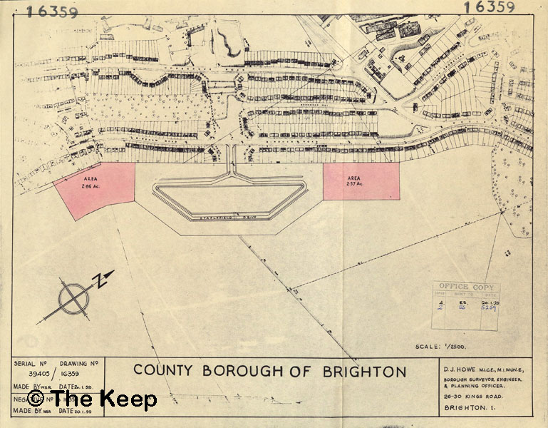
The plan is dated 20 January 1958. Keep Ref: DB/D/84/24/16359.
The pink area on the right is the site built on by the Staplefield Self Builders. The road is named Wheatfield Way.
The land in Higher Bevendean was originally part of Lower Bevendean Farm formerly owned by Steyning Beard and purchased by Brighton Council on the 29th September, 1913.
The man behind many of the self-build schemes in Brighton was Councillor Desmond Manton.
A group of men who lived with their families in council houses in Moulsecoomb formed the Staplefield Housing Association Ltd.
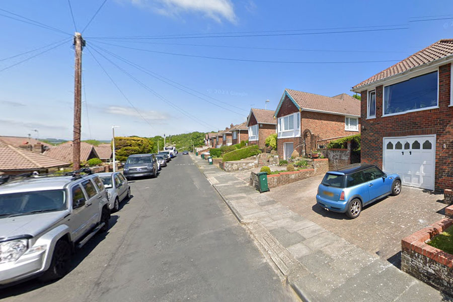
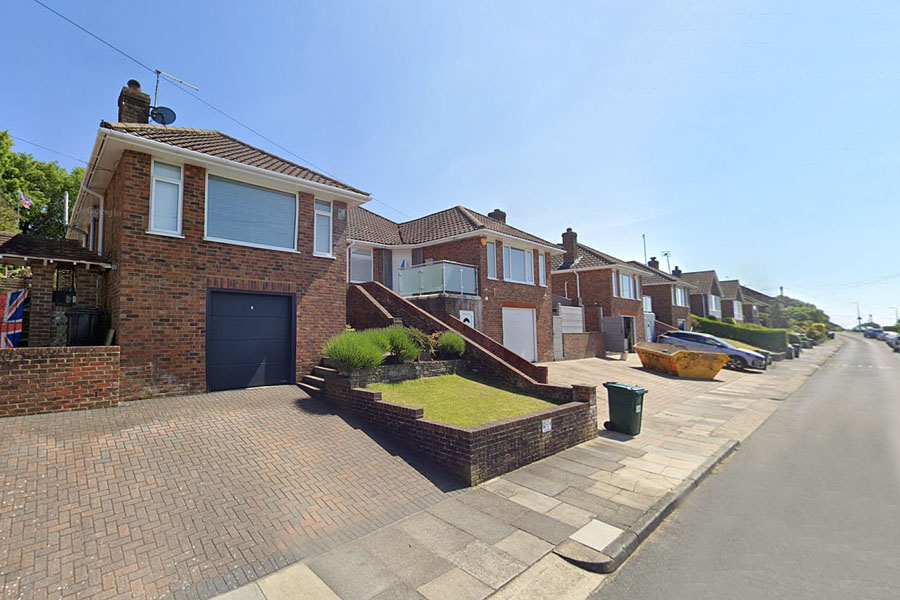
Wheatfield Way view north showing a garage built under one of the bungalows. Image from Google Street View © 2023 Google.
Plans for the 13 pairs of semi-detached bungalows in Wheatfield Way were approved by Brighton Town Council on 3 February 1959.
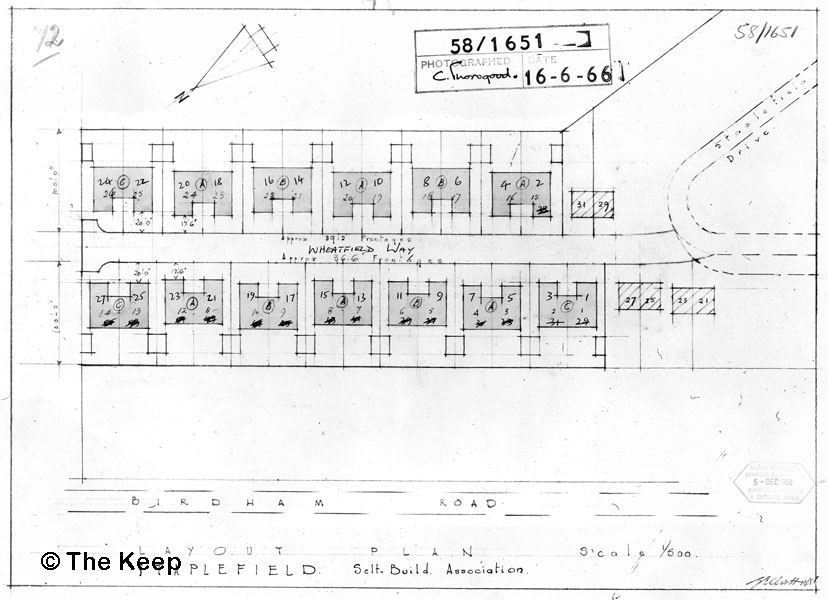
Layout of the house plots in Wheatfield Way. Keep Ref: DB/D/139/58/2/1651
Date: 16 March 1961
The men built 26 bungalows in Wheatfield Way and were able to move into them in the early 1960s.
The buildings on the west side of Wheatfield Way were built with a small storeroom underneath because of the slope of the land. Garages were built behind the bungalows with a shared drive from the road.
Those on the east side had garages built underneath the bungalows.
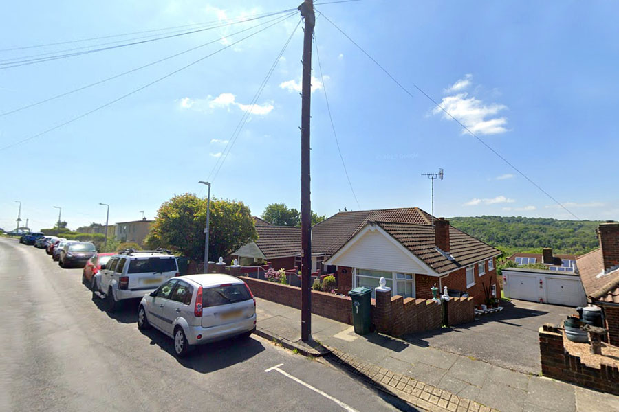
Wheatfield Way view south with 2 garages visible down the sloping drive from the road. Image from Google Street View © 2023 Google.

Drawings showing the elevations for the bungalows on both sides of the road. Keep Ref: DB/D/139/59/2/200/4
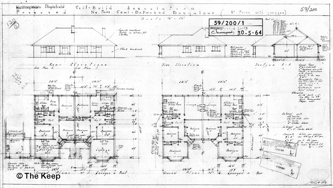
Drawings showing the ground plans for the bungalows in Wheatfield Way.
Keep Ref: DB/D/139/59/2/200/1
Wheatfield Way view south showing the bungalows with garages underneath. Image from Google Street View © 2023 Google.

The plan is dated 20 January 1958. Keep Ref: DB/D/84/24/16359.
The pink area on the right is the site built on by the Staplefield Self Builders. The road is named Wheatfield Way.
The land in Higher Bevendean was originally part of Lower Bevendean Farm formerly owned by Steyning Beard and purchased by Brighton Council on the 29th September, 1913.
The man behind many of the self-build schemes in Brighton was Councillor Desmond Manton.
A group of men who lived with their families in council houses in Moulsecoomb formed the Staplefield Housing Association Ltd.
Wheatfield Way view north showing a garage built under one of the bungalows. Image from Google Street View © 2023 Google.
Plans for the 13 pairs of semi-detached bungalows in Wheatfield Way were approved by Brighton Town Council on 3 February 1959.
Layout of the house plots in Wheatfield Way. Keep Ref: DB/D/139/58/2/1651
Date: 16 March 1961
The men built 26 bungalows in Wheatfield Way and were able to move into them in the early 1960s.
The buildings on the west side of Wheatfield Way were built with a small storeroom underneath because of the slope of the land. Garages were built behind the bungalows with a shared drive from the road.
Those on the east side had garages built underneath the bungalows.
Wheatfield Way view south with 2 garages visible down the sloping drive from the road. Image from Google Street View © 2023 Google.
Drawings showing the elevations for the bungalows on both sides of the road. Keep Ref: DB/D/139/59/2/200/4
Drawings showing the ground plans for the bungalows in Wheatfield Way.
Keep Ref: DB/D/139/59/2/200/1
Wheatfield Way view south showing the bungalows with garages underneath. Image from Google Street View © 2023 Google.